20 May 06
...
Gwanaksan, Seoul, Korea
...
So, you may be wondering why this blog doesn't talk about letterboxing all that much. It's not because we've fallen out of love with our dear hobby but rather because there isn't a single letterbox to hunt in this whole country (apart from the few we've planted ourselves--and it's not much fun to hunt out ones you've already found)--so we continue in our cacheboxing adventures until that time when we return to the wonderful land of copious letterboxes.
...
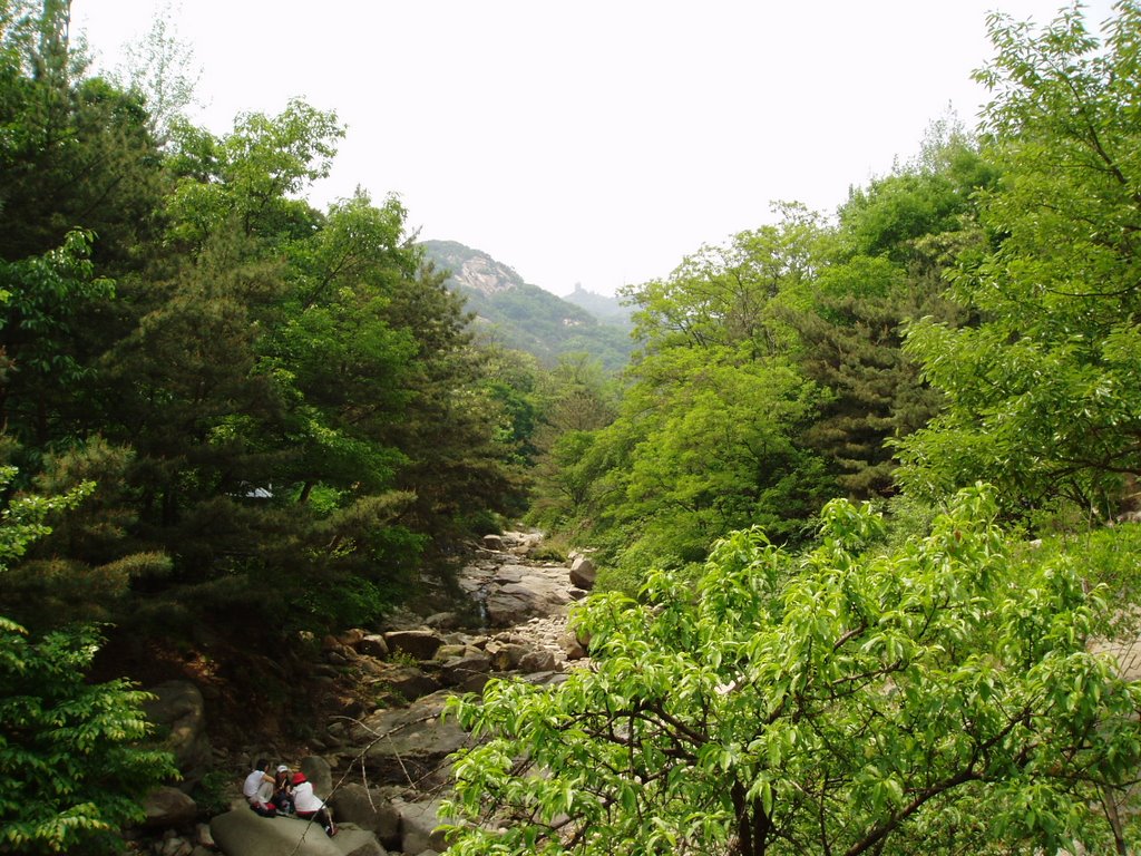
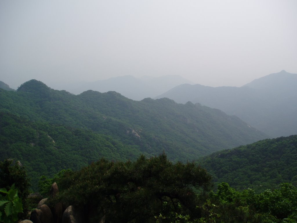
In the meantime, we wondered why rnrB & trkr immediately fell asleep this evening upon returning 'home'. This is something that rarely occurs in our household--so when it does happen we're always wondering what caused it. In this case we think it was because of this really cool hike we undertook earlier in the day. We returned, yet again, to Gwanaksan--an amazing mountain range southwest of downtown Seoul. Again we hopped the subway to the station nearest the most 'publicized' entry point to this vast hikers' haven and started the trek up the 'easy route' which was along this stream bed.

This was our third hike around Gwanaksan and yet again our third different route we've taken to the ridgeline. Previously, we'd taken the steep & treacherous route from the southeast that hugged the eastern ridgeline (this is where our 2 letterboxes are hidden--and as we learned from painful experience where no geocaches are hidden)--followed it to the summit, hugged the ridgeline heading west and then followed a rugged intermediate ridgeline back down to about 1 km from where we first entered the mountain-range. That was the hard route! So, this time we were hunting geocaches on the other side of the ridgeline so we opted to take the more direct route which was straight up the chasm between the two ridgelines we'd already hiked so then we'd have more time to hunt out geocaches on the other side.
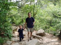
trkr & Trekkie following the rugged 'easy trail' that follows the stream bed up to Gwanaksan. Easy or difficult the trails around here aren't flat, smooth dirt or pine-needle graced paths but rather rocky, boulder laden and uneven gravel trails--almost the entire way! Quite a contrast from our usual hiking paths we seem to encounter back home. Here it's like a continuous stair-master machine.
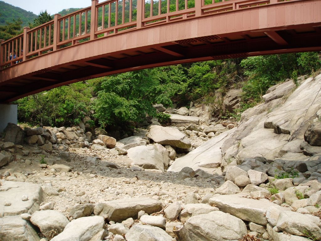
We forego the bridge to cross the boulders of the streambeds. It hasn't rained in ages--as we know quite well thanks to the heavy aerated yellow dust that remains lingering in the atmosphere around here. The massive stream-bed is bone dry save for a few spots where natural springs feed it a few meters before the water returns to its subterranean channels.
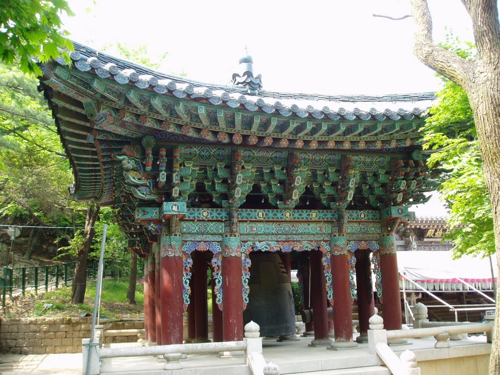
We eventually reach one of the temples near the summit of
Gwanaksan. I think I've photographed this temple building before--this time I actually noticed the giant bell hanging beneath the temple. Where was it last time? ;)
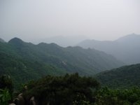
We reach the summit and get a great view of the various ridges on the northern side. Had the haze lifted you could actually see the highrise buildings of
Seoul scattered beyond the peaks.
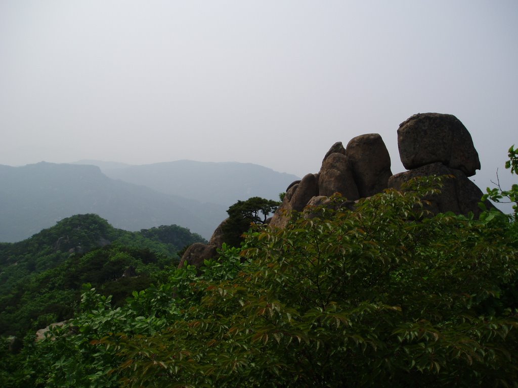
It's difficult to tell from this picture but this is looking north from the summit and there are two large chasms--one before the large boulders to the right and then another immediately after those boulders and before the smaller summit to the lower left of the photo. These are very rugged and steep mountains around here. The leaves have finally filled out in the trees and in addition to the thick
Yellow Dust in the air there is also lots of pollen floating around, too. My black backpack ends the day looking yellowish-green it is so covered in pollen!

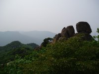
Here's another angle looking at the northern chasm.--this time angled to the west. To take this shot I'm perched on a pointy boulder with sheer drops to both of my sides. I don't realize how high this perch is until after I take my shot. Then my fear of heights reminds me of the crazy predicament I put myself in as I try to locate handholds & footholds to lower myself down safely without dropping the camera. The rocks in the bottom center of this shot are actually about 500m away on another peak.
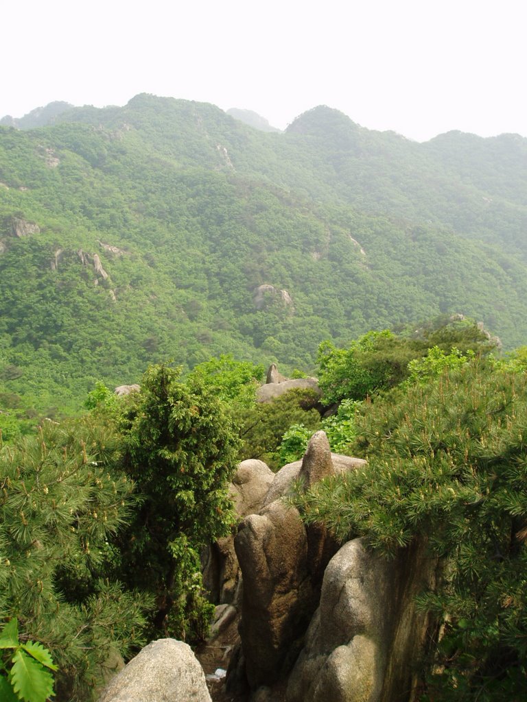
The greenery is just so beautiful now--even with the Yellow Dust haze looming overhead.
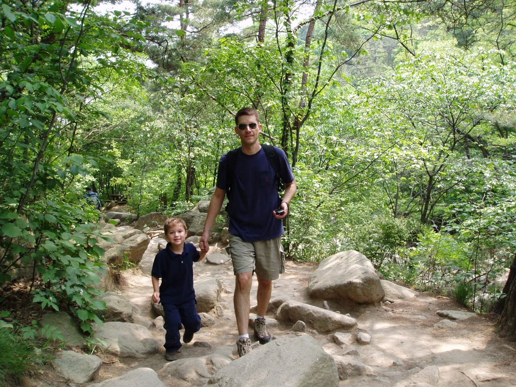
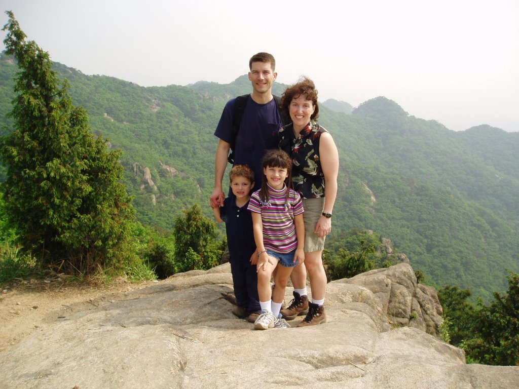
We finally got an opportunity to snap a photo of the entire family on one of the intermediate peaks along the way. We're standing on a massive boulder!
Navigating down the rugged mountain to a lesser peak.
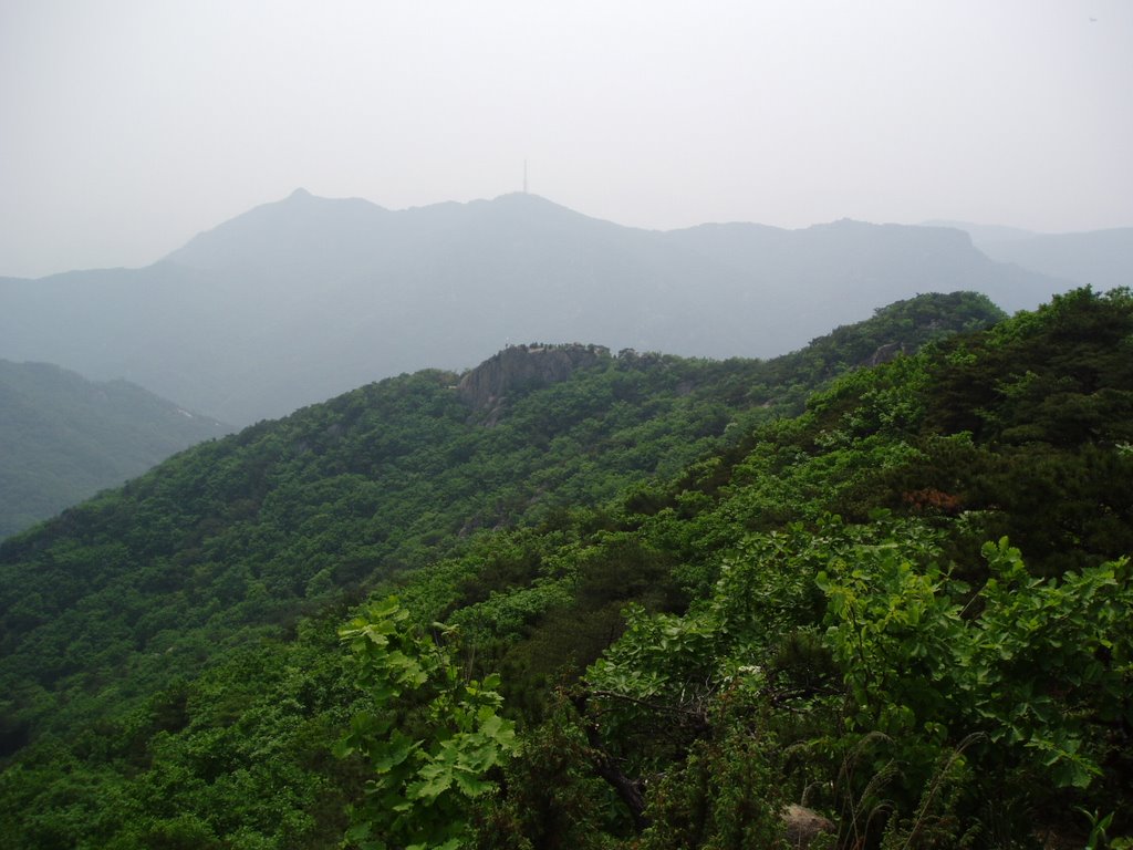
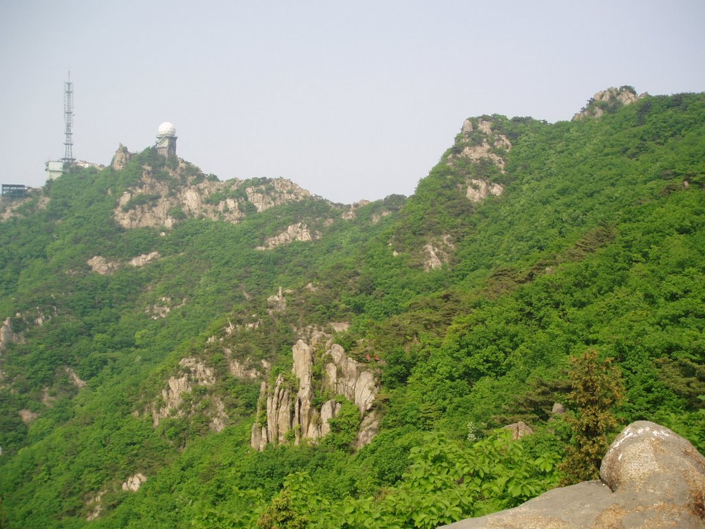
A view of Gwanaksan's communications tower looking south. On a previous hike we were standing right at the base of the comms tower. This time we were about 400m away from it to the west where we crossed over the ridge.
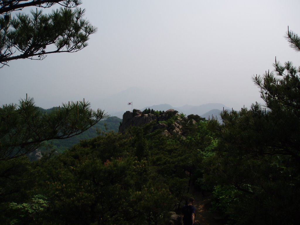
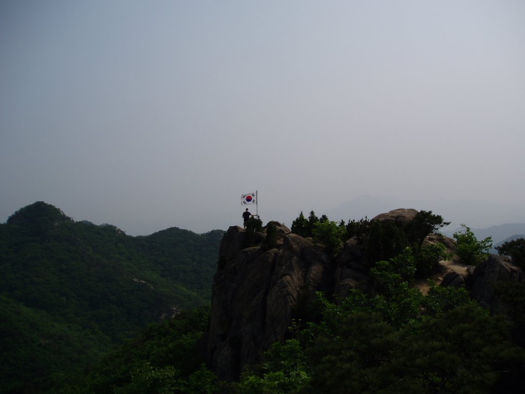
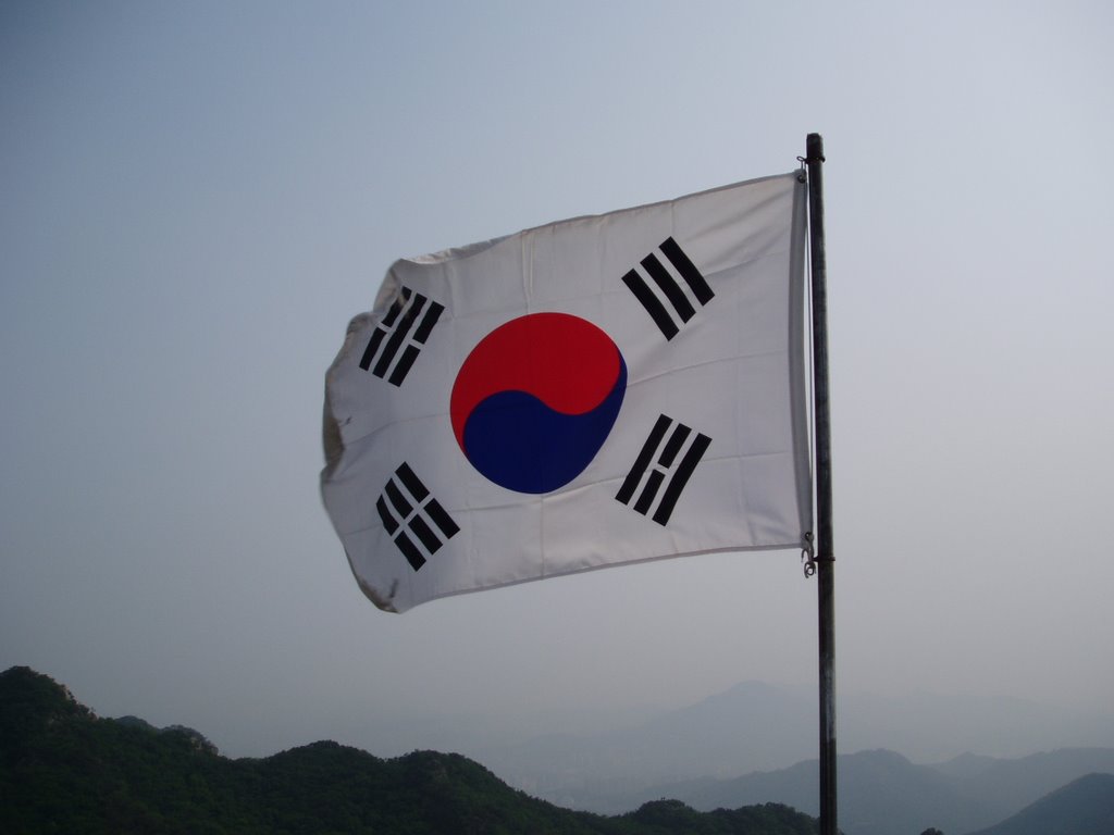
Peeking through a break in the trees, we spy a Korean flag (known as the Pal Kwai or '8 marks' for the 8 black marks around the yin/yang symbol in the center which represent different characteristics of the country) waving proudly atop one of the lesser summits to which we're heading. Here the flag is perhaps 1km away.
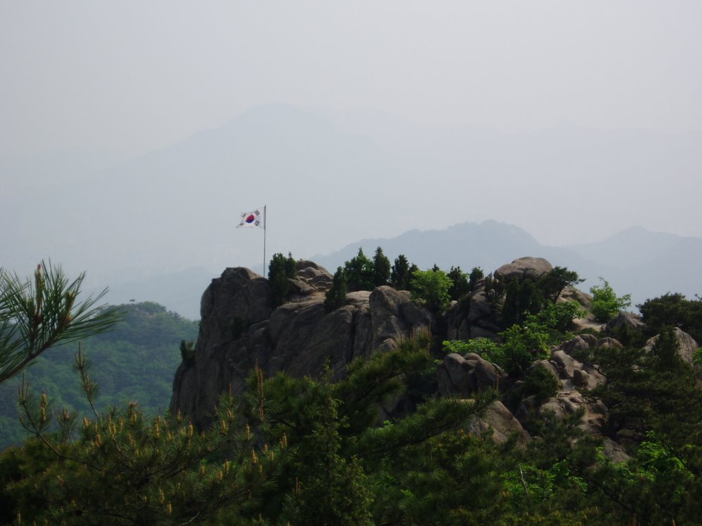
Getting closer to the Korean flag--now it's about 500 m away.
Here Trekkie is standing at the base of the flag--can you see him?

Finally, we reach the flag! However, our geocache goal is still some 300m away and about 100m lower elevation-wise. So we continue along our trek. At times we get a little frustrated because we think we may be on the wrong ridgeline to reach the geocache (something which occurs frequently when geocaching in Korea). Had we been on the wrong ridgeline we would have had to climb back up to the summit (near the comms tower) and then retrace the ridgeline heading to the west--that would have meant another 2km of rugged hiking to reach the correct 'general area'. Thankfully, we continue along, realize we're on the right ridge all along, and eventually reach ground zero (where the GPS suggests the geocache should be). We hunt & peck and peck & hunt around the area for a couple of hours (yes!) and come up with absolutely nothing! It's probably the longest geocaching or letterboxing hike we've ever undertaken that didn't reveal a find at the end. A big, phat DNF! Phat? Phat-because even though we didn't find our geocache goal we still experienced an incredible hike along the way. It took us to breathtaking views and along trails we had no idea existed. Once resigned to thinking the geocache was just plain missing (or buried deeper than we had the tenacity to explore) we decided to continue hiking to the north and just take the next subway station that we find. Following this 'spontaneous' plan takes us to some really neat spots along the way. We find another large streambed (this one actually has water in it) where many folks are soaking their feet after their day of hiking. At this point we've been hiking for some 7+ hours and really want to soak our feet too but we're not sure how much longer it will take us to find the next random subway station.
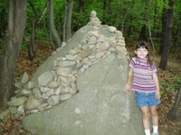
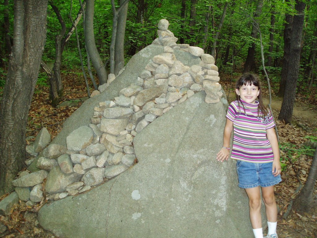
We forge ahead and find this neat boulder that passersby have converted into a cairn of sorts. It just looks cool, doesn't it?
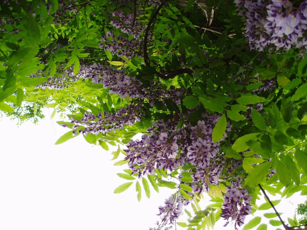
We eventually reach a large canal area on the backside of Seoul National University and stumble upon these gorgeous Wisteria blooms! Absolutely beautiful! It must really be Spring!!! We also find large pools of water in the canal that boast lots of large fish.
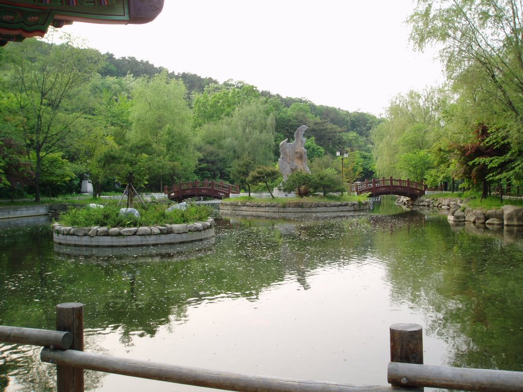
We also happen upon this beautiful pond. Who knew?
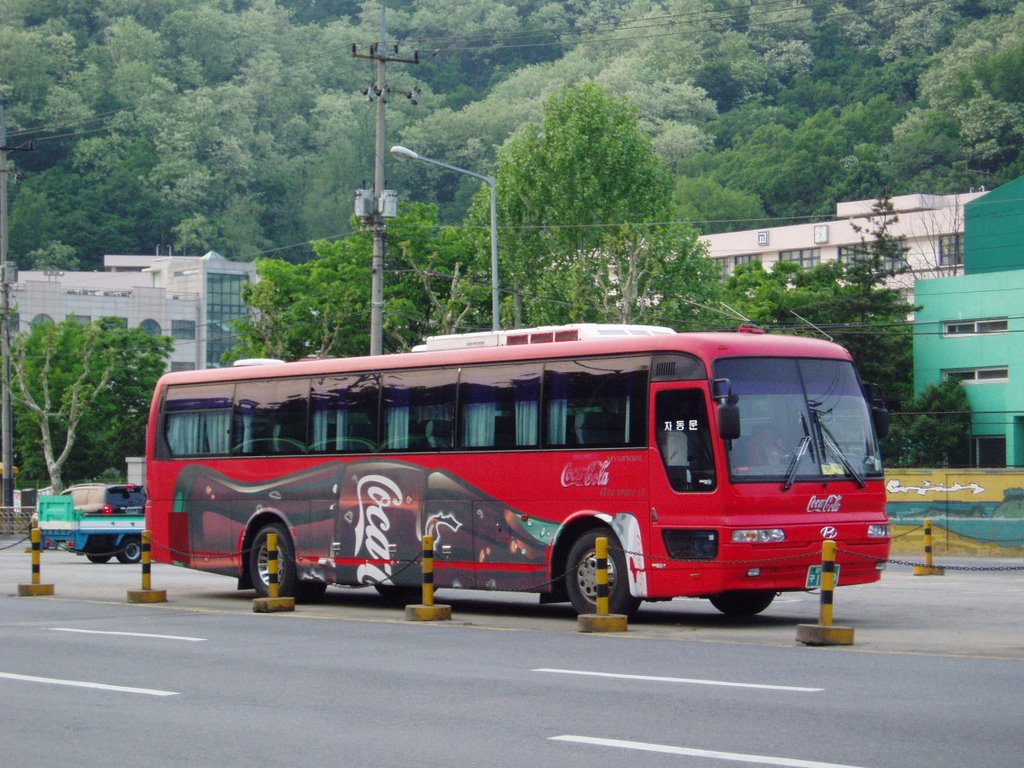
Then finally we home in on a main road that we hope will lead us to a subway station. Along the way, we think it must be fate. We actually spy a Coca Cola bus! The entire bus is decked out as a Coke bottle. Even the logo on the front of the bus (where the Mercedes star would be) is a Coca Cola sign. Amazing! After searching relentlessly all over Cambodia for a simple glass Coke bottle we end up finding a Coca Cola bus in Seoul!
...
Eventually, we reach the Sillim Subway station--and then the apartment. Once there we realize we've hiked about 15km on the mountain with a couple more kilometers to & fro the various subway stations--so that was why rnrB & trkr collapsed in slumber immediately after returning 'home'. Our big quest for the Gwanaksan 3 Geocache yields us a big, PHAT DNF (did not find). But that description is obviously a big, PHAT misnomer--as we really did find a lot of incredible things along the journey, didn't we?


0 Comments:
Post a Comment
<< Home